This is a pamphlet I wrote in 1991, revised and enhanced.
It was a study of then published software named "PageMaker".
I found .txt formatted files for "History", "01Central Area" and "02Sanaruko" in my HD.
Other files were saved in .pmd and there is no way to open them. I shall replace them with newer findings.
I will try to write them after Ando Hiroshige's "53 stations along Tokaido". People in older ages have no way than walk on their foot and this brings you of so many things than go on cars or shinkansen. If you walk on your feet, there are so many findings about what has changed from Hiroshige days and what don't change.
I feel happy if you copy and use it freely as a part or whole. I owe no responsibity from it's quotation.
7.1 2021
KOYAMA Keiichiro
〒430-0946
109-12 Motoshiro-cho
Hamamatusi
JAPAN
古山恵一郎
〒430-0946
浜松市元城町109-12
tel: 070-3140-1432
fax: 053-488-8433
e-mail:
ask@tcp-ip.or.jp
History
1 Central Area
__contd.
2 walk to Sanaruko
3 Imagire
4 Arai
5 Hashimoto
6 Washidu
7 Shiomizaka
8 Futagawa
e1 Kakegawa
e2 Kotonomama
e3 Sagara
5 ShiomiZaka
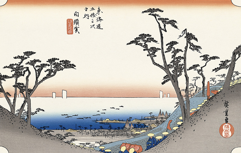
Tokugawa Bakuhu designated Shiomizaka as the highstreet of Tokaido at early 17the century reaching HashimotoJuku.
On this time, horse station of Shirasuka was at the foot of TakashiYama. Old site(right) of Shirasuka was washed away in 1707 tsunami.
Tokugawa moved it on top of TakashiYama(up left). This is Shirasuka village today.
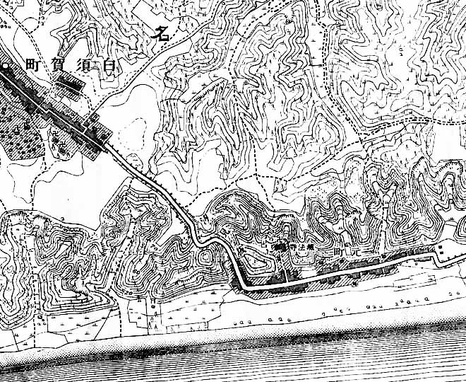
1890 map showing ShiomiZaka, not so altered as it was until then
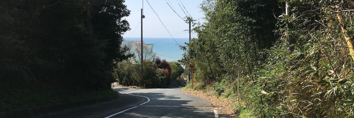
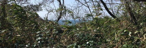
This slope was called ShiomiZaka(Oceanview slope).
Eventoday, the old slope is unchanged.
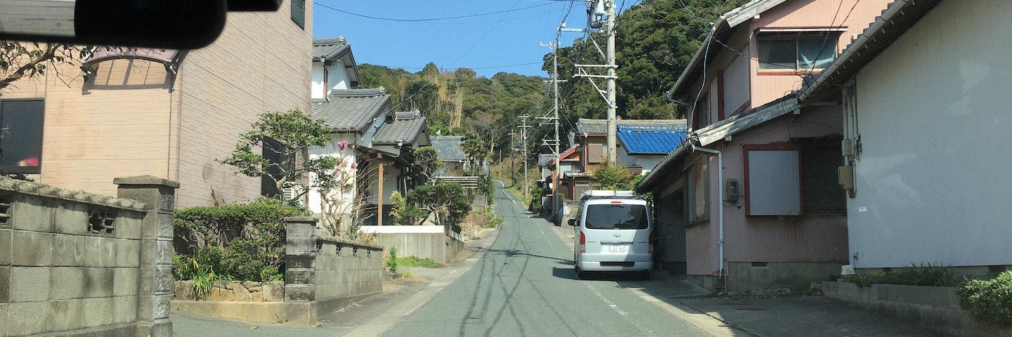
A few private houses are along the slope today enjoying the Oceanview.
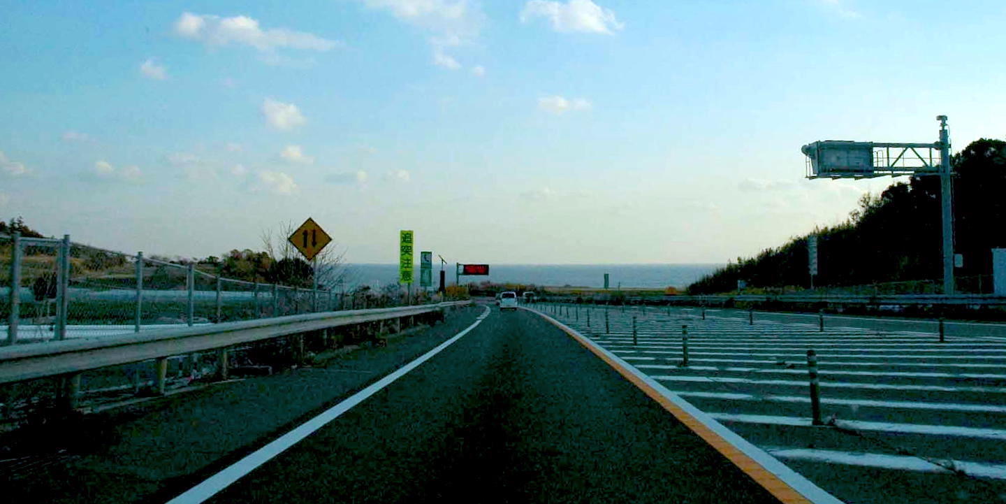
Today's highway R1 passes under a crossroad and jumps over TakashiYama into the Pacific Ocean, in your eyesight.
There is a Shinto shrine named Naiguu Shimmei Jinja. In Motomachi:Old town
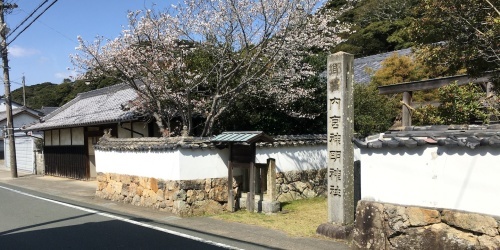
Naiguu means main shrine of Ise. It is raised 6-7m here and seems to be safeguarding against tsunamis.
3 Imagire
4 Arai
5 Hashimoto
6 Washidu
7 Shiomizaka
8 Futagawa